Extreme Weather Expected After Historically Wet 2019
LINCOLN- Nebraska’s farmers will not be surprised to hear that 2019 was one of the wettest on record, and Karin Gleason, a climate scientist with the National Oceanic and Atmospheric Administration, says all data indicate that extreme weather events like this year’s floods, along with periods of prolonged drought, are here to stay.
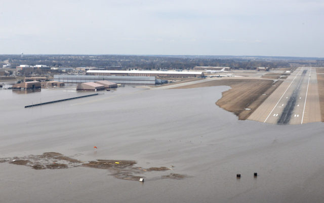
This year’s flooding in Nebraska, which could be seen from space, resulted in damage costing more than $1.3 billion dollars…
In just the past ten years, major flooding in the US resulted in losses of at least $ 40 billion. Gleason says extreme precipitation events are becoming heavier and more frequent. She explains that as global temperatures rise, more water evaporates from the land and oceans, leading to stronger downpours which increase the likelihood of flooding.
Gleason and her colleagues at NOAA are monitoring changes in weather patterns and are making their data available for farmers. She says looking back at historical rainfall averages, and days of drought, and how those averages are changing can help farmers adjust their strategies and adapt…
Both the Platte and Missouri rivers far exceeded their banks in 2019. The end of a runway at Offutt Air Force Base was under water, and the Omaha National Weather Service had to move to higher ground. Gleason says the easiest way to tap NOAA’s climate data is through its interactive tool, Climate at a Glance, which can be found online at www.ncdc.noaa.gov.